--------------------
  • Bachelor
  • Architecture
  • Civil Engineering
  • Geodesy and Geoinformatics
    • ----------
    • Profile
    • History
    • Professional Fields | Job Offers
    • DVocean
    • Application
    • Structure | Contents
    • Additional Information
    • Timetables | Dates
    • Examination Regulations
    • Contact person | Committees
    • Laboratories
      • ----------
      • Geodesy
      • Geoinformatics & Geovisualization
      • Hydrographie
      • Photogrammetry & Laser Scanning
      • ----------
    • Scientific events
    • Professors
    • Staff
    • Förderverein
    • Instrumentenausleihe
    • ----------
  • Urban Planning
  • Metropolitan Culture
  • Techn. Gebäudeausrüstung (TGA)
  • Fachübergreifende Studienangebote
  • Jobs
  • Studierendenvertretung
--------------------

Photogrammetry & Laser Scanning Lab

Head of Laboratory

Prof. Dr.-Ing. Thomas P. Kersten

Room 5.002

Phone: +49 40 - 428 27 - 53 43

Email: thomas.kersten(at)hcu-hamburg.de

Office hour in WiSe 2014/2015:

Tuesday 2:30 - 3:00 pm or by eMail appointment

Academic assistant

Dipl.-Ing. Dirk Stallmann

Room 5.002

Phone: +49 40 - 428 27 - 52 00

Email: dirk.stallmann(at)hcu-hamburg.de


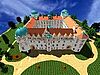
Projects of the Photogrammetry & Laser Scanning Lab


3D Data Acguisition and Modelling of historic significant Buildings in North-Germany by Digital Photogrammetry & Terrestrial Laser Scanning


Geometrical Accuracy Investigation into Terrestrial Laser Scanning Systems

mehr...


Ancient Water Ressources Management - Documentation of the Great Dam in Marib in Yemen by Terrestrial Laser Scanning & Photogrammetry

Publikations of the Photogrammetry & Laser Scanning Lab

Here the available equipment of the lab is summarised.

Lehrveranstaltungen

Bachelorstudiengang Geodäsie & Geoinformatik
--------------------------------------------------------

Modul Photogrammetrie (4. Semester)

Modul Geodtäisches Seminar (4. Semester)

Modul Luftbildphotogrammetrie (5. Semester)

Modul Fernerkundung (5. Semester)

Airborne Laserscanning (5. Semester)

Modul Architekturphotogrammetrie (6. Semester)


Masterstudiengang Geodäsie & Geoinformatik
------------------------------------------------------

Modul Nahbereichsphotogrammetrie (1. Semester)

Modul Terrestisches Laserscnning 1+2 (2. Semester)

Modul LiDAR & Remote Sensing (3. Semester)

3D-Visualisierung im Modul Visualisierung (3. Semester)